University of Miami: MBAs to Conduct Economic Impact Study
A team of School of Business MBA students will conduct an economic impact study to analyze the potential benefits of revitalizing one of Miami-Dade County’s neglected real estate assets – the 10-mile “Underline” linear green space below the Metrorail southern track.
“Their objective will be to pick two stations on the southern line that have the most potential for commercial development and would benefit from an urban linear park,” said Andrea Heuson, professor of finance and head of the Accelerated MBA in Real Estate program. “They will prepare their analysis and make a presentation later this semester.”
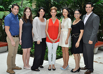
The UM team is led by Catherine Cai and Tom Speno, who are completing the Accelerated MBA in Real Estate program, and includes MBA students Thania Potosme, Mollie Halberstam and Jordan Levinson. Looking forward to the project, Potesme, who is now interning with a commercial real estate firm, said, “This is a really exciting engagement with a far-reaching impact.”
To begin the consulting engagement, Heuson and the five students met September 12 with Meg Daly, founder and president of Friends of The Underline (formerly known as Friends of Greenlink), and Hillit Meidar-Alfi, founder and CEO of Urban4M, a Coral Gables company that will offer its geographic software tools to the students as part of this project. “Your work will involve identifying where the bulk of the economic impact will occur and how we can make it happen,” said Meidar-Alfi.
Daly said the UM MBA students will be focusing on one of the most important elements of the rapidly evolving master planning process for the Underline. “We believe the adjacency to U.S. 1 and the Metrorail stations creates great opportunities on the north side for future transit-oriented development.” For example, the Douglas Road station has a pedestrian bridge over U.S. 1, and also connects to the Coral Gables Trolley and Metrobus routes. “That creates an exciting story for private developers,” she added. “Your analysis and findings will be a big win for the vision of the project.”
The linear park underneath the southern Metrorail line starts near the Brickell Station and continues 10 miles to the Dadeland South station, including segments in the Miami, Coral Gables, South Miami and unincorporated Miami-Dade. Its primary current use is the M-Path, a winding asphalt trail for biking, jogging or walking.
“We want to create a safer and wider protected pathway for pedestrians and bicycles, while adding lighting, seating, landscaping and outdoor activities along the Underline that bring life to communities,” said Daly. For instance, the green space near the UM Metrorail stop could be turned into the world’s longest Frisbee park.
Summing up the initiative – which is supported by local communities and the Miami-Dade County parks and transit departments – Daly said, “Green spaces are magnets for good development and we are looking forward to moving forward as quickly as possible to transform the Underline.”
Click here to see the article. 